12.3 BioDIGS

This section is primarily geared toward instructors as students will be able to get access to the BioDIGS data through their local C-MOOR Scholars chapter.

A multi panel image with photos and icons relating to BioDIGS. In the top left corner is the GDSCN BioDIGS project label, beneath which is a map of the United States with pins on each BioDIGS sampling site and a photo of two people collecting a soil sample. In the top half of the slide contains a pipeline for sampling soil, including applying for permits, pooling and homogenizing soil, taking photos, recoreding GPS and field notes, and repeating at different sites. Icons of soil, buckets, a smart phone, sample tubes, bags of dirt, and a plan for sampling replicates. On the bottom half of the image is a pathway from soil testing and DNA sequencing to computational analysis. Icons show a sample of soil being analyzed by a machine to look at levels of lead, cadmium, arsenic, organic components, and pH. On the right side are the icons for AnVIL, Galaxy, and Bioconductor next to a scatterplot.

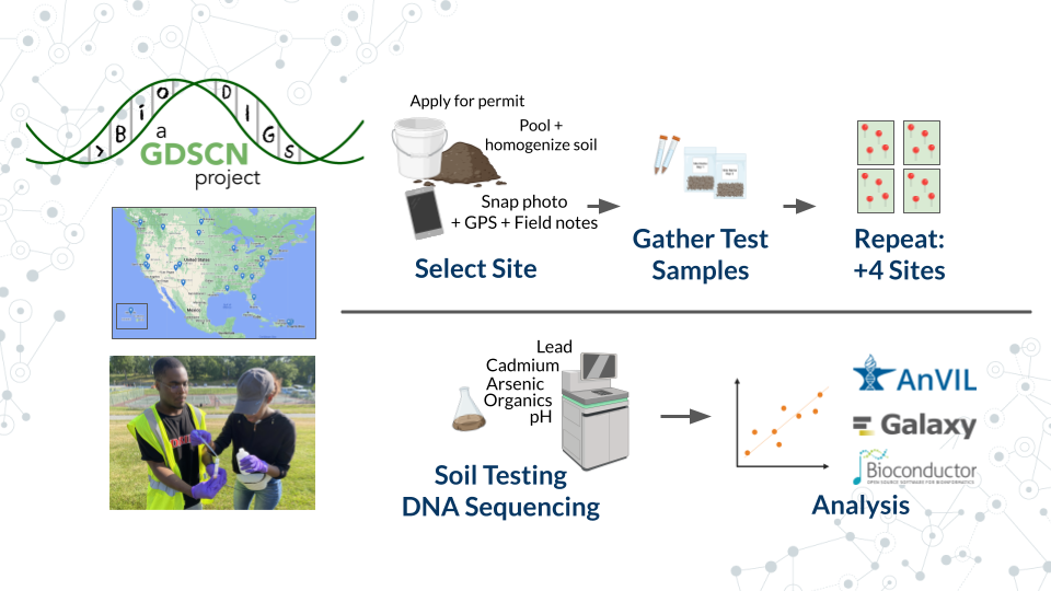
What is BioDIGS?: BioDIGS is a project from the Genomic Data Science Community Network (GDSCN), which aims to characterize the microbiome of soil throughout sites in the US while connecting scientists to research.

What makes BioDIGS different?: Soil is hypothesized to be the most diverse system on our planet, and BioDIGS is gathering sequence data and matching environmental data to elucidate the connection of soil microbes to abiotic variables and human health. Students at participating sites can take the entire project from soil sampling all the way through computational analysis. Curricula and more information on how to get a soil sampling kit are available on the BioDIGS website.